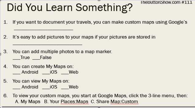
We've kept a map of our travels every year since 2004. For the last several years, using Google's My Maps we've made interactive maps complete with photos. This episode shows you how to do that with Google Photos. This episode was recorded live on Sunday, February 26, 2017. We were in our RV and did not have the best connectivity, but it is mostly still watchable. To be notified of live shows, subscribe to our YouTube channel and be sure to click the bell for notifications.
Opening Tip: Google Photos can be used instead of your native Photos or Gallery app. due to poor conectivity the live stream was blurry so we spliced in some other video.
Beginner’s Lesson: Using Google My Maps and adding photos from Google Photos.

No comments:
Post a Comment
Did you Learn Something? Leave a comment.